
$40 or with cover $43 (postage included)
Copies can be purchased directly from us via PAYPAL or by sending a cheque or money order for A$40.00 or with cover $43 (includes GST and postage to any Australian address) or for Overseas orders A$65.00 (includes air-mail and cover), to PO Box 5042, Laburnum, 3130, Australia. We also have clear plastic protective covers for an extra $3 each. Paypal transactions will appear in your statement as PAYPAL*JOHNCHAPMAN. NOTE - Credit cards can be used for Paypal payments - you do not have to have a Paypal account.
![]()
192 pages, 120 colour photographs, 41 colour topographic maps, ISBN 978 1 920995 11 9, recommended Price A$39.95 (inc GST). Second edition 2012 (previous edition 2003).
We have also produced two companion guides Short Walks Southern Tasmania
and Short Walks Northern
Tasmania which describe walks from 0.5 to 2.5 hours in length
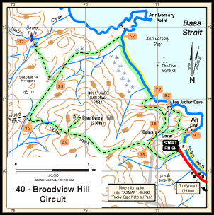
Describes 40 walking areas around Tasmania with a total of 98 walk variations. For each walking area, one walk is described in detail and a series of variations based on the main walk are also given if appropriate. Areas covered range from Apsley Gorge, Wineglass Bay, Cape Raoul, Cape Huay, Mt Wellington (3 walks), Hartz Mountains, South Cape Bay, Mt Field (4 walks), Mt Anne (2 walks), Cradle Mountain (4 walks), Ben Lomond, Mt Arthur, Cataract Gorge, Asbestos Range (3 walks), Mother Cummings Peak, Mersey valley (4 walks), Mt Roland, Black Bluff, Dial Range and Rocky Cape (2 walks).
Walks range from 6 to 22km in length. Of the 95 variations, there are 50 from 2 to 10km, 32 from 10 to 15km, 13 from 15 to 20 km and 3 walks of over 20km. Grades range from Easy to Hard and the grading is similar to that used by most walking clubs in Tasmania hence there is something for everybody. The guide includes walks of all standards, while many of the Easy walks are suitable for families, some of the Hard walks include off-track sections and are intended for experienced walkers.
Changes from Edition 1 to edition 2 are: all maps are now
oriented
north-south on the page, no need to run the books sideways to read some
maps. There are two new walks and another three walks have had major
track changes, in particular the 11km return walk to Tatnells Hill is
now a 19km circuit. There are also numerosu small changes such as new
car parks, track realignments and changed track conditions.
The book is a full colour production with colour topographic maps. Map sizes range from half page to 1 and a half pages for each walk and standard metric scales of 1:25,000 or 1:50,000 are used . The guide also includes a 2 page key map of Tasmania and a 6 page Walk Index designed to assist with selecting a walk.
One innovation over other books is the inclusion of gradient profiles showing climbs and descents (since copied by other authors). All profiles are the same scale throughout the book enabling easy comparison between different walks.
